



Tell
Members
-
Joined
-
Last visited
Everything posted by Tell
-
-
-
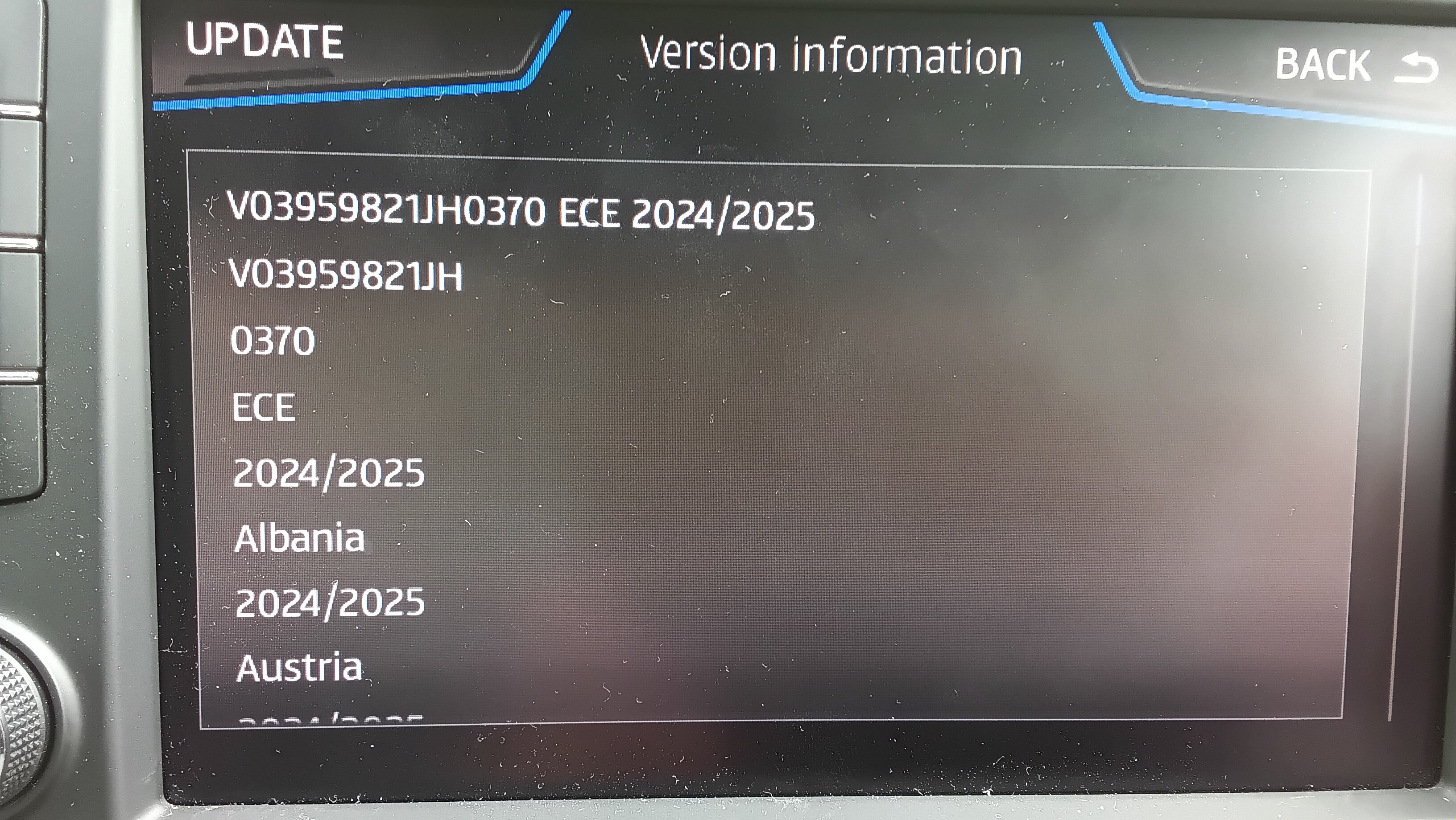
Yes these slimmed down mib2 high only versions were the preserve of Audi drivers only that got them on the paid mapcare subscription behind a pay wall previously. @pcbbc was familiar with them. The versions released on Skoda, VW and Seat were the combined mib 1/2 high release where they could be used in either unit. This release drops the mib1 high support but you must present all folders to the unit. The programmers have called the directionarys mib1 and mib2 but it needs both, just they got a rubbish directory naming convention. We had already seen a few months back the mib2 high only release of 370 in the Audi form curtesy of Russians boards and mibsolution.one. This file appears to be identical to that one except it has some additional checksums in it. The ones with the additional checksums are by country. I only checked the UK on these which demonstrated the early release of 370 was the same as this 370 for the UK once you ignored the additional checksums. VW must use a different way of manufacturing these files from the source materiel with more checksums or they changed their processes if it all comes from the same place. The main thing is not to get excited by the drop in file size. It's fine it's for mib2 highs only. Columbus, Seat Plus and Discover Pro and those Audi mib2 highs. Present all files as you have always done. You can use a Mac but you must use CleanMydrive to remove the Mac file garbage off the drive once copied before putting it in the unit else it will fail the integrity signature check.
- 27 replies
-
-

- 1
-
-
- columbus
- discover pro
- mib
- mib2
-
Tagged with:
-
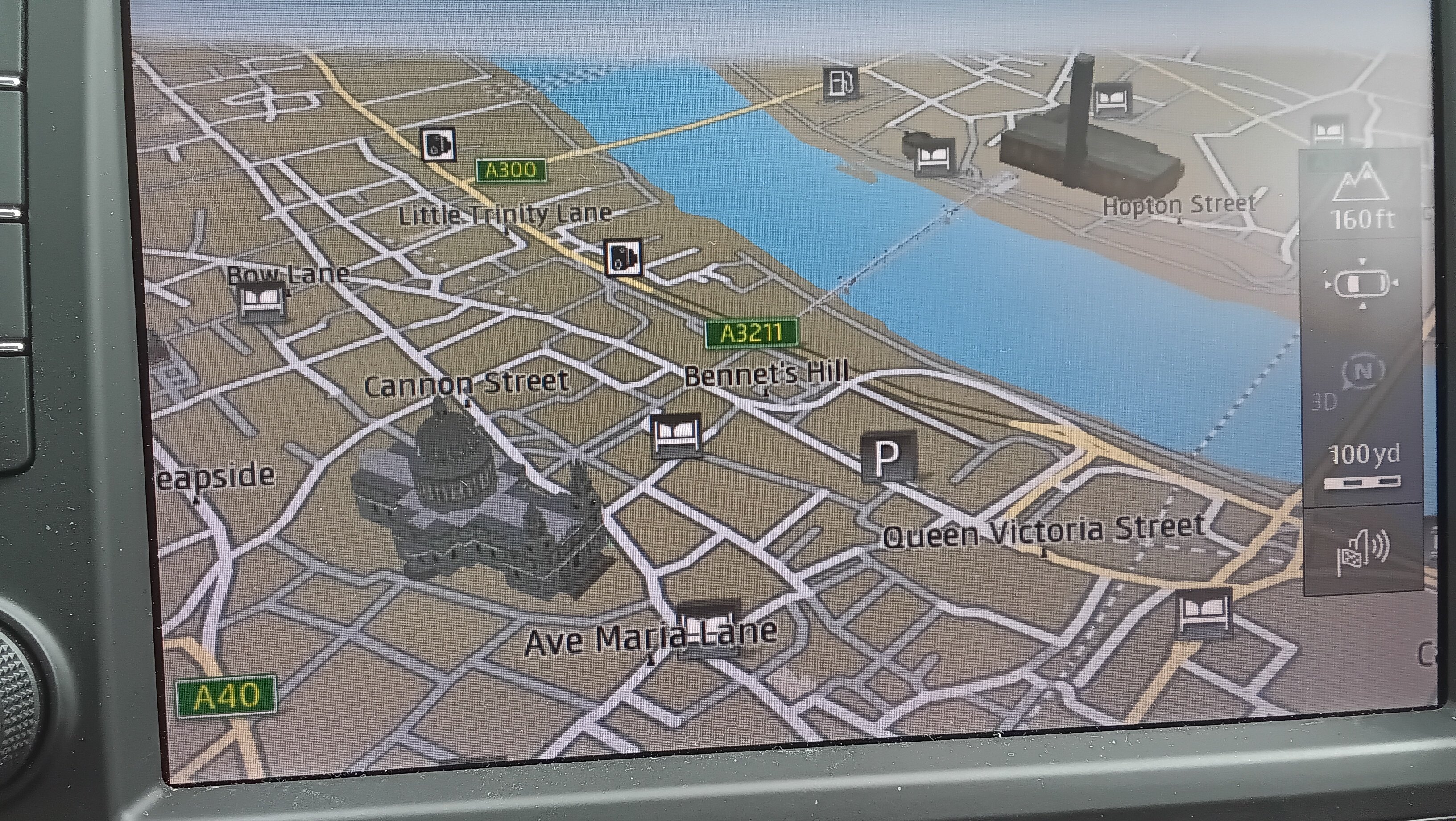
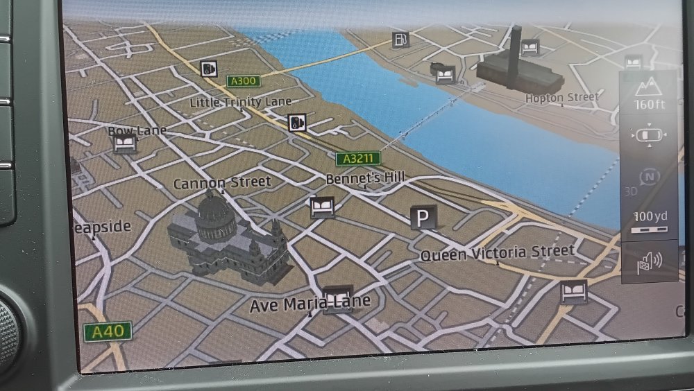
You want it on auto zoom. You have probably toggled it off or it's come up that way. Auto zoom is when a box is drawn around the button that shows in your case metrics or imperial in the UK. This is the Seat version of the mib2 layout. In this case you see 100yd with that ruler marking. Tap that box. It causes auto zoom to go on. Box round it, its in, no box it's off. Reckon that's it. Auto zoom and it should work fine. I've been using the Audi version of 370 for several months. My real test is Tuesday. But I reckon that's your issue. Normally. Set destination then tap to auto zoom. I always use 3D and the split screen on. Off in this photo. Hmm think you meant mib2 BTW. Not sure what would happen if you managed to load this file onto a mib1 high unit. You'd expect it to reject it. If that's the issue you'd have to use SWDL to force the old 350 into the unit. BTW you don't need to drive around to test auto zoom. You can put the unit into demo mode, under advanced setting or similar name. Select a destination and it will start a demonstration mock drive if it's a mib2 high atleast. It should do the zooms.
- 142 replies
-
- columbus
- discover pro
- maps
- mib
-
Tagged with:
-
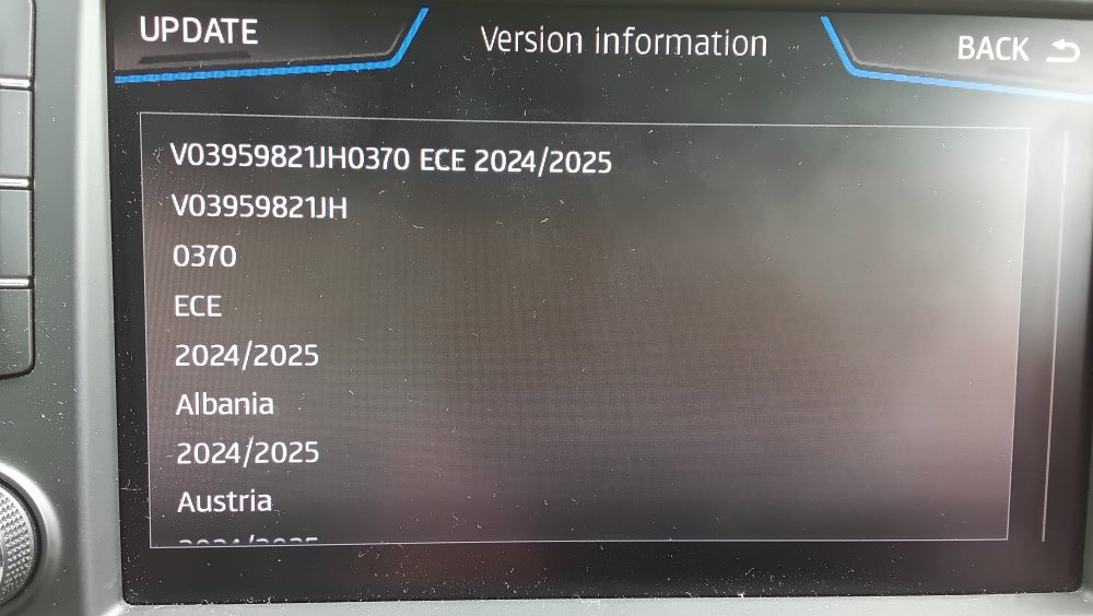
And lastly @MartiniB I installed over the Audi release, you have to use SWDL manual download, start and select all and start to do that. Result success screen: Ofcourse if you were on 350 you'd install as you normally do. Since I already had 370 installed and it had said, yes you got it, for the hell of it and to respond to a question about whether 3D mapping was still in it, yes it is. Failed comparison someone had done between the combined normal mib1/2 high files as the mib2 high only one. So yes I reckon you can make a new thread.
- 142 replies
-
-
- 1
-
-
- columbus
- discover pro
- maps
- mib
-
Tagged with:
-
Think you might find the dab aerial wire in the rear glass. People in the past have broken the connection by vigorous cleaning. The other one you could check is whether you got it set to auto select region or something. This is where you are happy for it to switch between similar stations. If you have it toggled as no then you can end up on one that you loose and fades in and out. Commercial stations don't always have the best coverage as the BBC so if an LBC News hound say you may find it drops away as you go down a dip since there are no fill in stations. Happens in rural parts whilst the BBC stations are rock solid.
-
OK VW 373 version unzipped fine. https://vw-maps-cdn.lighthouselabs.eu/vw-maps/P373_N60S5MIBH3_ROW.7z Looking at my notes for the earlier Audi release, it was 376 that was America only. The link above 373 is sprinkled for RoW countries so it's probably fine. Good to test by our friends down under.
- 142 replies
-
- columbus
- discover pro
- maps
- mib
-
Tagged with:
-
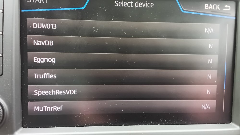
OK it tells me there is no work to do. That is to say each of the entities in the previous 370 release are the same as this. That's to say the VW mib2 high only release is the same as the earlier Audi 370 one. The N means it's the same release. I took the easy option of not forcing a reload. What I did find from the spot check of the files is that some had additional signature / meta checksums in which explained the increase in file size. Thus to me they are just prepared differently but from the same release material. Either 370 zipped release works from above. I'll have a look at RoW because before the Audi release to me it didn't include NZ / Australia, seemed lacking in those two area. I won't load it in the car thou. I'm not going to change to RoW FeCs but it is easy enough to do with the "Mr MIBonks" tool kit. One Skoda guy on the board did that once after updating to AIO in Australia but it installed EU FeC as the end. Needed it tinkering. https://github.com/Mr-MIBonk/M.I.B._More-Incredible-Bash
- 142 replies
-
- columbus
- discover pro
- maps
- mib
-
Tagged with:
-
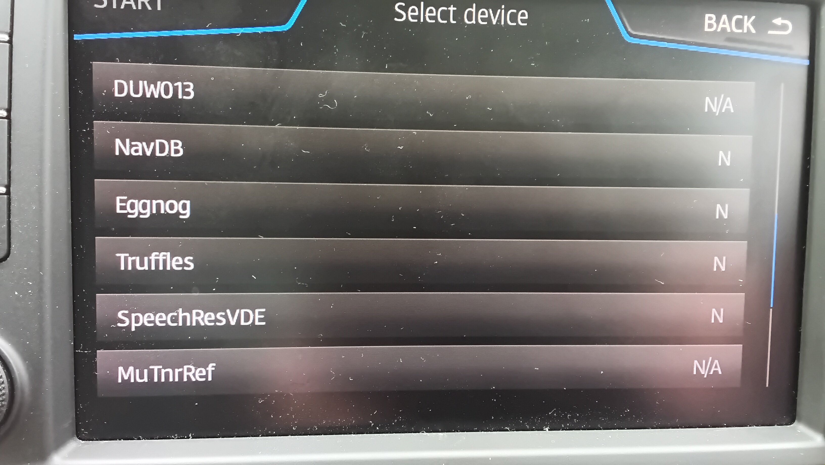
Haven't tried it yet but looking at the differences between the Audi version and the VW one in the files. Seemed that the cartography of the roads would be the same but the POIs may be different, like improved. There are entities of the files. I've never got down to the bottom of 'Eggnog'. Voice files are the same. Each of the entities has a version release so you can see via SWDL what you have against what's in the update. Each can be updated separately so it will be interesting to see whether the entities have the same release code, thats if they are faithfully retained. If so that would mean on paper the Audi 370 mib2 high only release was identical to the VW one. That will be a clue as to what has been changed. So I get the feeling the roads will be identical between releases the overlap GIS information may not be.
- 142 replies
-
-
- 1
-
-
- columbus
- discover pro
- maps
- mib
-
Tagged with:
-
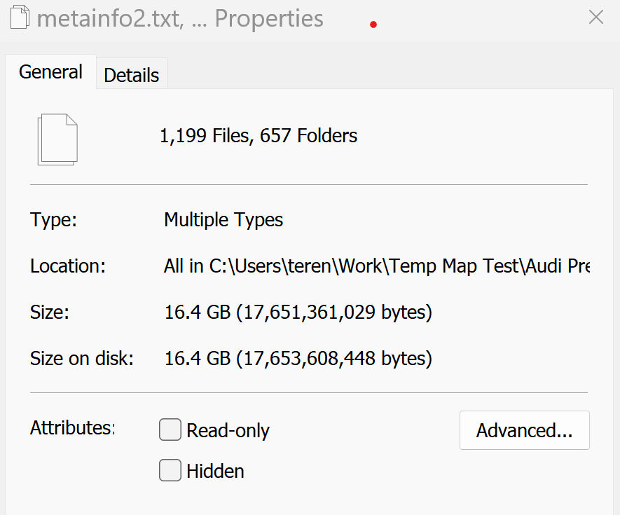
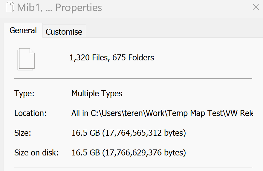
The Audi leaked 370 Mib2 high only one had a similar size. Applying the scientific method here 🤫. The VW link unzipped fine using this link https://vw-maps-cdn.lighthouselabs.eu/vw-maps/P370_N60S5MIBH3_EU.7z I took MartiniB's first one editing 370 in. VW unzipped: Audi unzipped total with the Russian additional files removed: It's grown from the Audi release. Given the Audi one was signed and loaded up fine our Russian comrades could not have fiddled with the directories so it's a new regenerated release. Doing a spot check on the file dates the Audi release shows 22/02/23. These 14/07/23 that’s found in \Mib1\NavDB\Ukraine_eu\0\default Thus, these have been re-run. I may be tempted to load it in the car tomorrow. I had found no issues with the "beta" 370. The SWDL option I use tells you whether it's a healthy files before it starts, so that will be interesting. Not using that menu it would not start due to failing that health check. SWDL just gives you a view on the component parts of the update. So yes feel free to use. On paper it would be a more up-to-date file. I used 7 zip.
- 142 replies
-
- columbus
- discover pro
- maps
- mib
-
Tagged with:
-
They can't get the staff these days 😂. Once there is a version that does unzip and it's a similar size then a check on that Audi version with this one would be good. May be they have pulled support on the mib1 side so you don't get the combined release. As we know they "incorrectly" label the two folders so mib2 material is in the mib1 folder, so the mib2 only release includes files in the mib1 directory. Just did a check on that leaked release verses your two files sizes, they tally so I reckon you are looking at the mib2 high release only there. VW pulling support on the mib1 high part of the traditional combined release. Do you want to give the link of your found one and I'll have a go at unzipping it. If it does unzip a cross check.
- 142 replies
-
- columbus
- discover pro
- maps
- mib
-
Tagged with:
-
You don't think those would be mib2 only rather than covering mib 1 which Audi normally release ?. The so called Russian leak.... On mibsolution.one site and Russian web sites. 370 for that loaded up fine so I'm going to stick with what I loaded up. The RoW one for that wasn't all of the world. Just America as I recall so no good for Ozz and NZ. 370 was fine, 373 wasnt what it seemed. I have had any no issues with it and it was an update from 350 cartography. That's linked here: I'm hoping for 390 in Autumn following along the early production of 370. We'll see. I'm not going to try the VW link let others.
- 142 replies
-
- columbus
- discover pro
- maps
- mib
-
Tagged with:
-
Yes it's on Martini's top post. The 6.9gb one. Take the VW they are better prepared. When I say take its suitable for the UK. The areas shown it covers.
- 98 replies
-
- amundsen
- discover media
- maps
- mib
-
Tagged with:
-
Mine came from a budget air flight which caused a collapsed ear drum... then old age. Channel whistle. Where you do need another noise to cover it up. I passed on the drugs which were prescribed. Psychotic, I Googled them. Pharmacist said take double. Yeah. Decided I didn't need to take psychotic drugs to cover up a whistling sound 🤣. So yes not my surround sound system in this case.
-
You see quite a few posts on Vag boards trying to connect subwoofers and power amps to stand mib2. Unlike old car systems which had crossovers in the speakers or close to the speaker, the crossover is done electronically now so each speaker gets fed it's own frequency response by the mib2 unit. So if you plumb into that output its been tinkered with so the mid range output won't have the base frequency in it. Ditto the tweeter out. The subwoofers driven from within the amp if enabled needs specific coding. Skodas may have the more flash power ampliers under the seat connected via coaxial / optical digital link... the ones where guts say I have a Canton etc. So you see people wiring up external power amplifiers to the mid range output on projects and hoping for the best if they haven't bought the fancy system which was an option. Also these days the speakers are glued into the door. Old days you'd unscrew them. Cut the glue, replace and stick. Really car speaker projects of yesteryear is finished as they have become more designer to the car and the units built in infotainment system dont lend themselves to speaker upgrades as the output is already trimmed to specific speakers, the electronic crossover that you didnt have in the past. They were like home AV systems, now the infotainment system has elements of home surround sound processor in it but unlike those these feed each speaker whether tweeter, mid range or subwoofer and location. Home systems still have crossovers in a speaker enclosure. Some frequency processing goes on in those so the sub only gets sub. Wardrobe speakers , yes Nottinghill carnival springs to mind. Put the speaker on the pavement 🤣. Anybody who drives around with thudding sub woofers needs to be hung quartered and whatever. You don't need it. Ditto mufflers.
-
The story is they never built tmc into mib3, connect services only for traffic. Don't think Which would shift the Vag group. They were still happy to charge Seat and Audi customers just for map updates whilst VW and Skoda got them free - Which detested that but they continue doing it. 2020 was when mib2 stopped being fitted. The map updates are considered to have a 5 year period. That's coming up for free stuff. The other web sites for POI import crumbled shortly after 2020. Pretty ruthless in wrapping up the old, thus it was self help on TMC to shift it onto the one still broadcasting. You have to help yourself if you have a Seat or Audi on free maps updates so we were use to that. Poi import on all brands of mib1 and 2 if you want to do it that way. As for mib3 it's pretty diabolical as a navigation system from what I've seen. I've got no wish to buy a car with it. Ditto mib4 shortly. I'm sitting out till mib5 🤣. I like the cars system to work like a traditional navigation system not a cross between Google maps with poor memory storage. Pay as you go as well although the map updates you can do on all vag brands out of contract. Radio logos are an issue on mib3.
-
-
I have seen people mount a card sharing thing with SD in front of the USB slots with a WiFi 5ghz adaptor. A Heath Robinson affair. Technically it proves a USB extender can be added which also has an SD reader in it although you can buy USB 3 to SD adaptors if you really want SDs to put music files on rather than SD. I have a USB-A to SD on my new laptop that didn't have an SD reader built in. I'm sure there will be the same for USB-C but bumping about in the car, reckon best to use USB-C sticks. Reversible ones (USB-A / USB-C) are recommended for offline map updates if you don't have USB-C on your PC. Adapters may not have all the pins connected. Where some people fail on mib3 firmware / map updates via a stick. Apparently retrofitters that sell firmware for mib3 find this quite common with their clients who cant get the firmware installed, whilst others say no it's not an issue with the right adapter. Not for them it wasn't. Something to look out for. The make do mentality ("engineering approach") verses rather than getting something for the job. In the glove box behind the blanking plate is the actually mib3 units. It's how they are presented now. You have to be carefull with what you do in RHD cars just there. The glove box often drops further once fitments are moved on the gliders to reveal the fuse box and pollen filter so the glove box is also a hidden maintenence area. Putting things in there may hinder service.
-
On the last it's probably true. It isn't that much different to the mib2 high. You might at this stage coming off contract have to wait a bit till your maps are "old". The offline ones get a published update in June and November unless @MartiniB finds them ahead. Generally does. Dependent of what country you are in mib3 connected services are sold differently on how they are unbundled.
-
Yes that's the market in flow data. It's how HereMaps get their analysis data on any roads sneaking up by putting the mobile track data over them. Problem with that they get builders roads so when crowd sourcing sees what appear to be new roads on housing estates which are in fact temporary builders roads they pass validation since they look at the mobile phone track data. The bulldozer drivers mobile phone in their pockets, the delivery driver to the temporary store area. They should look at the builders published plans and local authority planning maps but don't. That's how builders roads get in. Then it's a devil of a job to get rid of them. New estates where this silliness occurs. It also gets into Google Maps and TomTom. Then all the map providers copy each other by digital analytic of each others products, flagging up areas to investigate. A failure of validation in one gets replicated, if each fails to remove the dross.
-
Accurately neither Skoda or Vag turned it off the provider stopped providing it. Distributed company based service. Detailed exposition of the system here: https://en.m.wikipedia.org/wiki/Traffic_message_channel If you look under Operation Worldwide tab you see there were two providers in the UK till Trafficmaster (Teletrac Navman) brand pulled out. It was that brand that Vag cars used together with some other manufacturers. Inrix the other UK provider continued it went under ITIS previously. https://inrix.com/ It's was @bigade1 and @pcbbc that provided the details to knock the Vag receivers onto that channel using the built in facilities already in the Here Maps tables in the map data. Following a process similar to what had been done in Australia to get import cars on the Australia SUNA Traffic Channel system. That was the previous English language enthusiasts project. The UK became the next as Trafficmaster pulled out in April 2023 from the RDS transmission in the UK. The issue of longevity of the broadcasts is unknown as @pcbbc said. Contract obligations to gather the data for their UK clients and car manufacturers and satnav providers to make the products available. Google provides flow data to routing algorithms piggy backed onto effectively spying on your Google app in the phone but doesn't actually provide what the issue is. Waze uses crowd sourcing of users reports but may not be accurate. Inrix official sourced data of road works etc augmented by flow data where they have it. That one is "official". The UK Highway Agencies are now tied into Inrix https://inrix.com/case-studies/uk-highways-agency/ Provider maps England https://www.trafficengland.com/ Wales https://traffic.wales/road-traffic-map Scotland https://www.traffic.gov.scot/ These reports I believe you now find in the in car Inrix based system as the official source of traffic data. It was Trafficmaster at one time but that ceased as the demise and contracts shifted. Those service station displays now gone. So that's the official source of Inrix data in the UK as far as I can see, when the transmission of this data stops to cars via FM is possibly anybodies guess. Connected cars and the use of Apple and Google products to give customer data has a bearing. The Mib3 VAG unit does not provide traffic data over FM / DAB its now a paid for service as part of the connected cars contract. Google / Apple products are free. Microsoft also has its own apps together with Here Maps and TomTom. All the apps tend to be flow based whilst Waze has crowd sourcing. Inrix in the car remain the official data I would say from the sources as far as the UK is concerned but a different type of data. Congested areas where fast routing is required TMC may not be the best. I haven't seen the mib3 connected cars implementation in use, whether this is just Inrix data or enhanced flow data added, pass. You might get the best of both worlds, the official reports plus the routine algorithm based on better real-time flow data.
-
You can jump as big as you like on a Skoda or VW they have life long FeCs, Seat and Audi need navigation FeC surgery. No mac involved where you should run CleanMyDrive on the drive once on the external media ?. Only the use of Macs requires that. They put dross in the files which cause the signature check to fail so it would not see the update since it failed the integrity check. The zipped file has to be put in at the correct level. Some manage to get it one down so the system won't see it. There have been questions about Skoda zipping. Always best to use VW files they have better QA. You can be a devil and use the 370 release which will be June 2024. Boo boo found that. Works fine and newer cartography. You won't need that 64gb drive since it's only mib2 high. Doesn't contain the extras stuff for mib1. Just unzip and present the file. That's an Audi file so top notch. https://www.briskoda.net/forums/topic/518018-columbus-map-update-2024-mib12-high/?do=findComment&comment=5829922 The VW manual attached which gives details on what the map file should look like on the media once unzipped for either case. Hit the relevant update that Skoda says to kick it off. Discover_Pro_November_2020_EN.pdf
- 142 replies
-
-
- 1
-
-
- columbus
- discover pro
- maps
- mib
-
Tagged with:
-
That's a mib2 standard. The mapcode shown on the screen is also a clue since we know those. Us non Skoda people like to place them in the generic standard and high. The fly in the ointment with the mib2 standards is to look for this: To determine whether it's a Technisat (the one it works with) if it starts with MST2 and ends with T, MST2_EU_??_XX_XXXXT its a Technisat and the solution works.
-
Why the threads winding and having moderator profile on the Seat one I put it in the resource 🤣 You can read what it says on the map card. If it doesnt uses a map card it's a mib high, if it doesn't it's a mib standard. Next question is mib 1 or mib 2. Most people know if they have a mib 3. Mib3 2020 and on to 2024. No TMC over radio it's all 4g online connected services. Mib2 from 2015-2020. Mib1 5 years before. Audi slight different. The firmware it's running also tells you what it is. No mapcard with maps showing its a mib2 high if in the date range. Map card required it's a standard unit. By far Skodas use mib2 highs. Seat being a more cheapskate brand tends to be mib2 standards. I did do one Seat persons with a mib2 standard who got in a mess. It's all very straight forward if it's the card based system and know your way about a PC. The main thing is take a copy of the card before you start so you can get back to where you started. The Seat guy's error was copying pcbbc's overwrite next to what was there but not overwriting it. Once shifted to where it should be it worked. Was a simple beginners file copy error. BTW it's winding thread since it turned into a campaign thread at times. No chance of Vag doing anything about it. It's self help which I said at the start. Vag has signed off mib2 and mib1. They are on mib3 now. When stuff vanishes from their website that's it, they aren't supporting it. It's self help then.
-
Because I put them there but they are on the thread here where the work was done with credits here. If it's an Amundsen (mib2 standard) then no coding but you copy in revised file to the V12 maps (like yours). If Columbus (mib2 high) then you do need coding. Mib2 standard: https://www.seatcupra.net/forums/threads/updating-the-inbuilt-mib2-satnav-mib2-tricks-and-mib1.388586/page-136#post-5037297 Mib2 high: https://www.seatcupra.net/forums/threads/updating-the-inbuilt-mib2-satnav-mib2-tricks-and-mib1.388586/page-136#post-5035425 There are some mib2 standards which are the wrong type, mentioned. Your firmware tells you if you got that. Mainly VW units but seems a few Skodas do. All mib1 units whether standard or high just need the coding changed to traffic group 14 rather than 15. Additional to the links above.